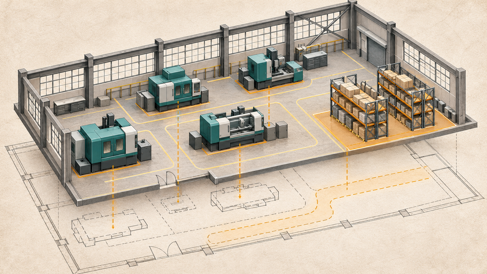
The automation proposal looks convincing. The simulation is polished. The equipment specifications are detailed.
Then someone walks the floor.
A machine has moved. A storage area now occupies part of the proposed route. An overhead installation is missing from the drawings. The digital plan and the operating facility tell different stories.
Before asking what physical AI can do in your building, ask a less glamorous question: How recently did anyone verify the building it will operate in?
That question matters whether the project involves mobile robots, a production-line change, or a broader digital-twin initiative.
The industry signal is real—but the local starting point matters
In an October 19, 2026 announcement, Siemens described work with NVIDIA at its Erlangen factory using digital twins to validate production scenarios before implementation. It is a useful example of virtual planning being connected to factory operations. Read Siemens’ announcement.
The implication for other facilities is not that they should buy the same technology stack. It is that decisions made in a digital environment depend on the information and assumptions behind that environment.
An existing building presents a particular challenge. Its history may be spread across drawings, equipment records, project folders, and the experience of long-serving staff.
Those sources remain useful. The task is to understand where they agree with current conditions—and where they do not.
A believable model can hide an uncertain baseline
Appearance and fitness for purpose are different things.
A detailed-looking environment might still contain unverified geometry. A current scan might omit an inaccessible area. A correct layout might describe the building during a quiet shift rather than the conditions that matter during peak operation.
This is why “we have a digital twin” is only the start of the conversation.
Ask when the underlying information was collected, what it covers, what was inferred, and which decisions it was intended to support. If those answers are missing, the team needs to establish them before treating the model as a dependable planning reference.
Capture the questions that could derail the project
For an automation pilot, begin with the proposed operating zone and its interfaces with the rest of the facility.
That could include equipment footprints, adjoining circulation routes, staging areas, doorways, service access, and visible overhead constraints.
The project team should identify which dimensions require verification and which conditions may vary during operations. Capture planning should then reflect those priorities.
A helpful exercise is to ask each discipline: “What assumption would force us to redesign this project if it turned out to be wrong?”
The answers make a better scope than a general request to scan the entire site.
Geometry is a foundation, not a working robot
Reality capture can provide a record of observable spatial conditions. It does not, by itself, establish how a robot will behave, how people will move, or whether a deployment is safe.
Simulation preparation, equipment behavior, operating rules, material properties, system integration, and validation require additional inputs and expertise.
Keep those responsibilities visible in the project plan. The capture provider should understand the required spatial outputs. The integration and engineering teams should define how those outputs will be used and validated.
This distinction makes the capture more useful. It directs attention toward a specific handoff instead of an undefined promise of “AI readiness.”
Turn the baseline into outputs people can use
Different reviewers may need different ways to work with the same site information.
An operations manager may need a navigable view for remote discussions. A designer may need AutoCAD drawings or a Revit/BIM model. A project manager may need Compare views showing visible changes across capture dates. A facilities team may benefit from tags linking locations to approved asset information.
These should be scoped as deliverables, with named users and acceptance criteria.
For modeling work, confirm the required elements, detail, coordinates, and software compatibility. For visual access, confirm permissions and hosting. For tags, identify who supplies and maintains the linked information.
The important handoff is from captured information to a decision someone can actually make.
Keep the record from becoming another outdated plan
A capture date is essential context. Once equipment or layouts change, the team needs a way to identify which parts of the record remain current.
Consider defining update triggers rather than relying only on a calendar. A line relocation, major equipment installation, renovation milestone, or change to the pilot area may justify a targeted recapture.
Compare views can help teams review visible differences between visits. They should not be presented as automatic proof of dimensional compliance unless a separate measurement and verification process supports that conclusion.
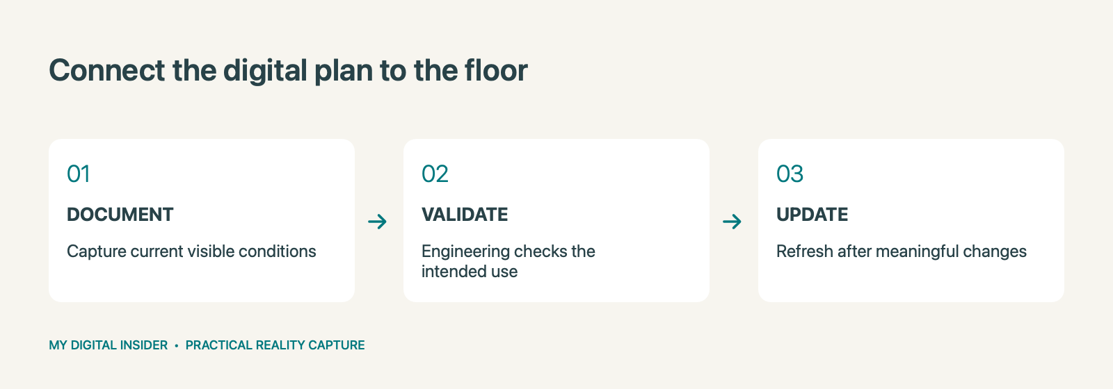
Assign an owner to this update cycle. Without one, even a useful new record can gradually lose its connection to the floor.
Start with one zone and one decision
A facility does not need to solve every documentation problem before beginning.
Choose a bounded area tied to a real project. Define the decision, the receiving team, and the minimum useful set of outputs. Capture that area, review the handoff, and record what the team still needs to verify.
An illustrative pilot might document one proposed equipment relocation, provide a visual review environment, and supply the drawings or model needed for coordination.
Evaluate the result using practical questions: Did the team resolve its spatial uncertainties? Could the intended users open and understand the deliverables? Were remaining gaps clearly recorded?
That creates a basis for deciding whether—and how—to expand.
Before you request a quote
Bring the proposed operating area, available drawings, required outputs, access constraints, and target decision date. Include the integration team early enough to define accuracy and format requirements.
Avoid asking providers to guess what “ready for physical AI” means. Describe the planning task and the information needed to support it.
For organizations that need help establishing this baseline, Capture Now 360 can scope reality capture and supporting deliverables, including CAD/Revit outputs, Compare views, and tagging.
Request a project quote. Start with the site, pilot area, and decision your team needs to make.
The technology may be new. The need to verify what is actually on the floor is not.
Related reading
Explore our related reality capture guide.
Ownership disclosure: This publication’s owner also owns Capture Now 360.


Leave a Reply