
A single property can produce a useful capture project through close coordination between a site contact and a provider. Across a portfolio, that informal approach becomes harder to repeat.
Locations have different access rules. Teams use different names for similar spaces. One manager wants a tour, another expects drawings, and a third assumes equipment tags are included.
The challenge is consistency without ignoring local conditions.
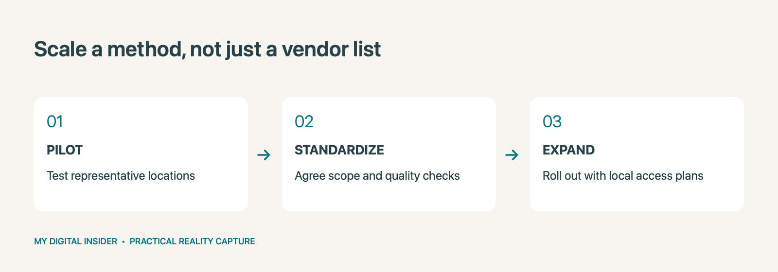
A portfolio program needs a shared method for defining scope, arranging access, producing outputs, and checking the handoff. Start small enough to learn, then expand the approach that proves useful.
Define the portfolio use case
Before requesting coverage across multiple markets, identify why the portfolio needs capture.
The primary purpose might be remote property review, renovation planning, operational documentation, leasing support, or a combination. Rank those needs rather than treating them as equally important everywhere.
A commercial leasing team and an engineering team may share some source information but require different outputs and permissions. Agree on a standard baseline and optional additions.
For example, a program could establish a consistent visual record at each property, with drawings or a Revit/BIM model commissioned only where a planned project justifies them. That is an illustrative structure, not a universal recommendation.
The right program is the one tied to the decisions your organization actually makes.
Select a representative pilot
Avoid choosing the pilot solely because it is the easiest location to access. It should teach the team something about conditions the broader program will encounter.
Consider building type, size, occupancy, operational restrictions, and the outputs required. If the portfolio includes materially different property types, one location may not test every part of the intended method.
Define the pilot’s success criteria before capture. Can the receiving team find and use the information? Are naming conventions clear? Are coverage gaps recorded? Does the local access process work?
Document the lessons and revise the program brief before commissioning the next group of properties.
Create a common deliverable specification
The specification should explain what every location receives and how additional outputs are selected.
Include naming conventions, room or zone identifiers, capture-date labeling, expected coverage, required file formats, and the process for recording exceptions. For drawings or models, define the scope and receiving workflow separately.
Also agree how tours, comparison views, and tags will be organized. A user moving between properties should not have to relearn the navigation or interpret a new labeling system each time.
Consistency is not the same as identical files. Different properties may need different technical approaches. The common standard is that the outputs meet the agreed purpose and are reviewed against consistent criteria.
Keep local access planning visible
A central contract cannot unlock a plant room or arrange an escort by itself.
Assign a local site contact and confirm responsibilities before each visit. Record approved hours, restricted areas, site induction requirements, and any operational constraints that affect coverage.
Ask local teams to review the scope map. They may identify occupied zones, temporary storage, or access issues that the central team cannot see from existing records.
Use a readiness check before travel is committed. If a critical area will be inaccessible, decide whether to change the visit, adjust the scope, or record an explicit limitation. Avoid treating an incomplete visit as complete simply because a date was met.
Use a repeatable quality review
A portfolio needs a review process that is specific enough to be useful and simple enough to apply.
Check whether required areas are covered, capture dates are clear, exceptions are documented, permissions work, and the intended user can open the outputs. For technical deliverables, include the appropriate specialist review of units, coordinates, modeled elements, or other agreed requirements.
Separate administrative completeness from technical acceptance. A populated folder and a completed checklist do not establish that the data supports an engineering task.
Track recurring issues so the program can improve. If several locations produce the same handoff problem, revise the standard or training rather than correcting each site in isolation.
Govern access across the portfolio
Decide who can view which properties and which information can be shared externally. A marketing view and an internal operational record may need different access arrangements.
Confirm account ownership, hosting duration, user administration, download rights, and what happens when a property leaves the portfolio or a service agreement ends.
For tags, identify where authoritative asset information lives and who maintains the links. For comparison views, decide which capture dates should remain accessible and how users identify the current record.
These decisions help avoid a collection of independent accounts and undocumented links that only the original project coordinator understands.
Plan updates around meaningful change
The first capture establishes a baseline. Maintaining that baseline requires an update policy.
Some locations may change frequently; others may remain stable. Consider triggers such as renovation, equipment relocation, tenant turnover, or a major operational change. The appropriate cadence depends on how the information is used.
Define whether an update covers the whole property or only affected areas, and how the new record relates to earlier captures. Preserve dates and limitations so a user can assess whether the information is current enough for a task.
An update policy should also include related outputs. New imagery does not automatically update a drawing, a model, or an asset document.
Measure adoption before expanding
Look beyond the number of completed locations. Ask whether people are using the program for the decisions that justified it.
Useful review questions include whether users can find the right property, whether outputs are accepted without repeated corrections, and which requests still require additional site investigation. Collect examples rather than assuming every avoided trip or resolved question came from the capture.
Keep the measurements proportionate. A small pilot can begin with structured feedback from the receiving teams. Larger programs may need a more formal record of usage, support requests, and deliverable acceptance.
Use what you learn to refine the next phase.
Request a program, not seven unrelated quotes
A useful portfolio brief includes the site list, property types, approximate areas, intended uses, standard outputs, optional deliverables, access constraints, and acceptance responsibilities.
Capture Now 360 can help scope a multi-site capture program with CAD/Revit outputs, Compare views, tagging, and relevant platform add-ons where needed.
Request a project quote. Share the portfolio overview and a proposed pilot location. Establish a workable standard first, then use that standard to make each additional site easier to coordinate and review.
Related reading
Explore our related reality capture guide.
Ownership disclosure: This publication’s owner also owns Capture Now 360.


Leave a Reply